


by
, , , , , , and


Antonio Campus

Quaternary 2023, 6(3), 45; https://doi.org/10.3390/quat6030045 - 08 Aug 2023
Abstract
In central Italy, the Charterhouse of Calci hosts the Natural History Museum of the University of Pisa. This monumental monastery was founded in 1366 by Carthusian monks. The Charterhouse has experienced various transformations over the centuries, until its abandonment in the 1970s. Since
[...] Read more.
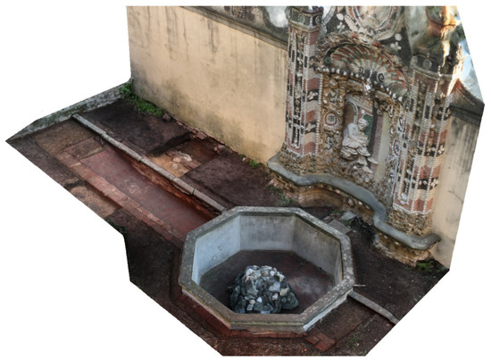
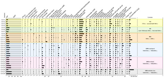
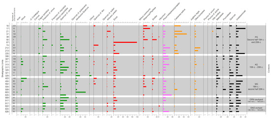
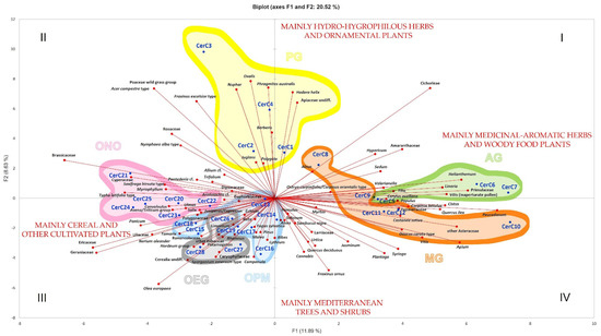
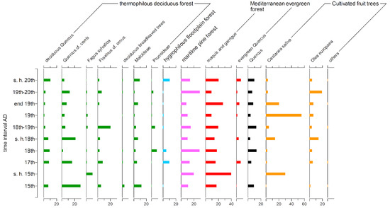
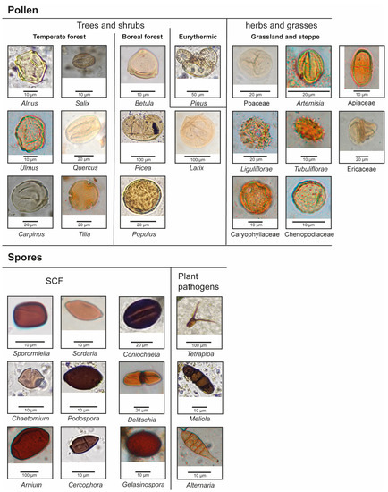
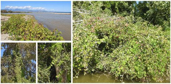
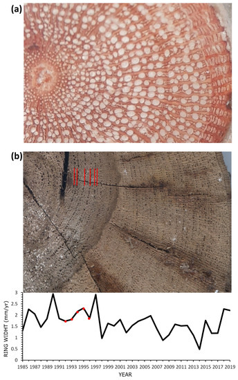
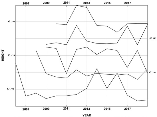
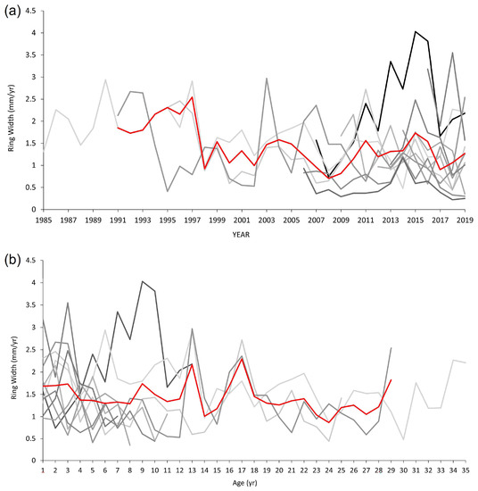
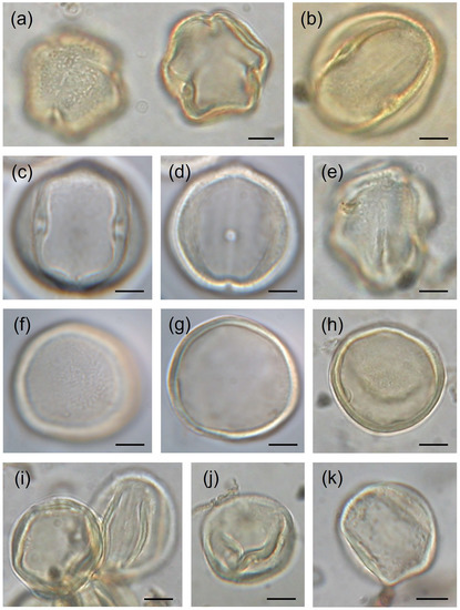
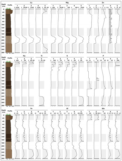
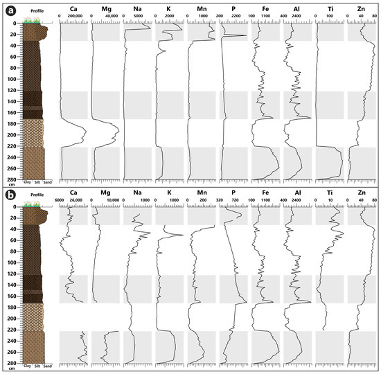
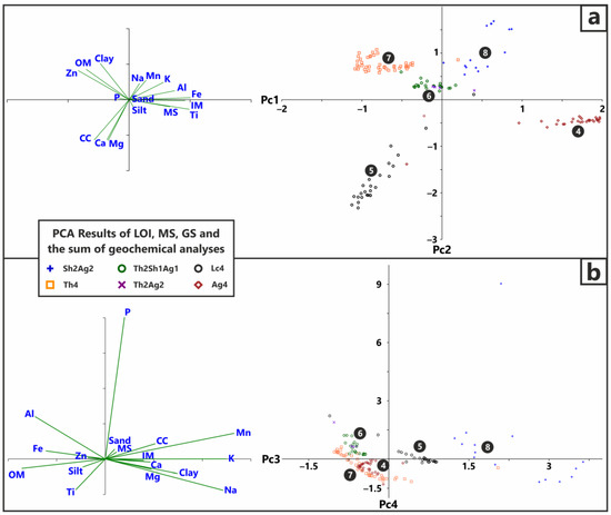
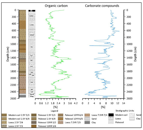
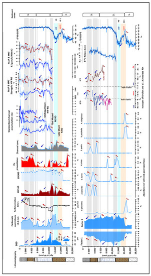
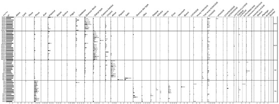
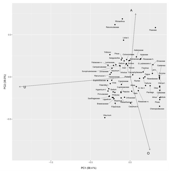
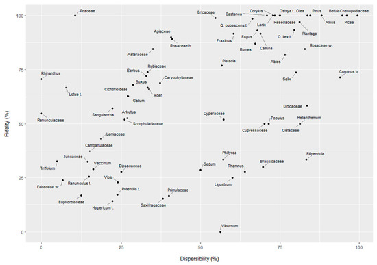
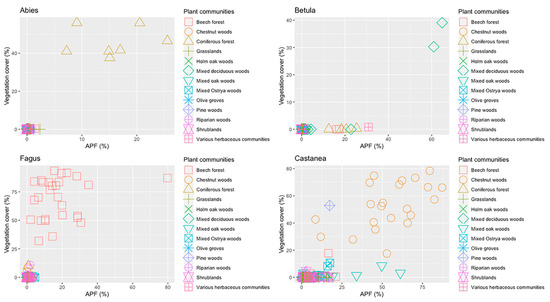
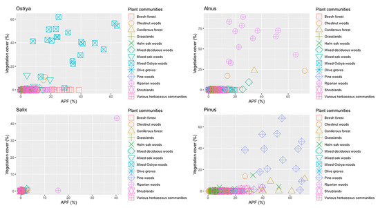
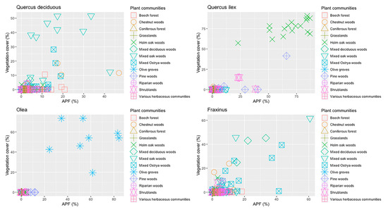
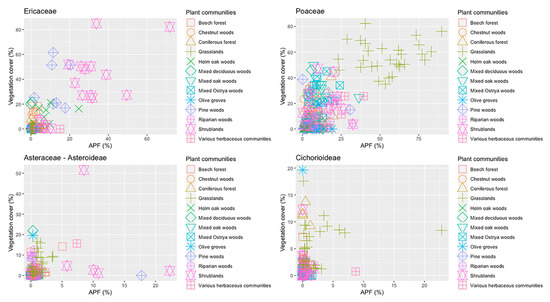
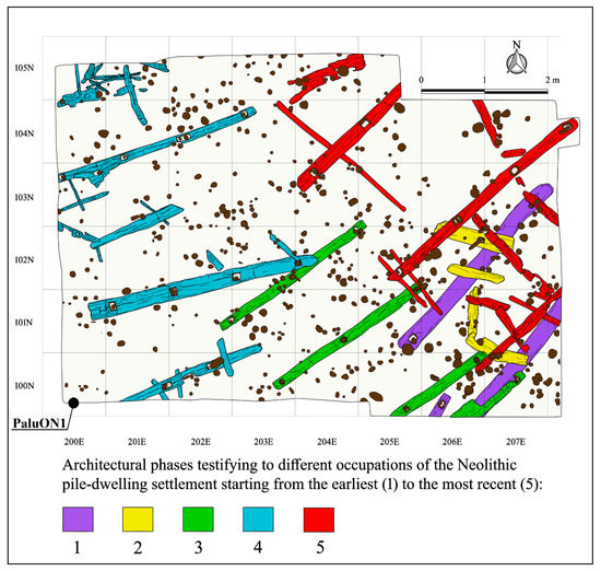
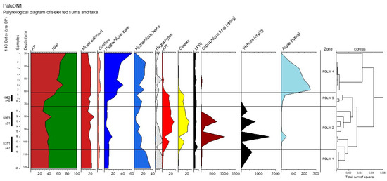
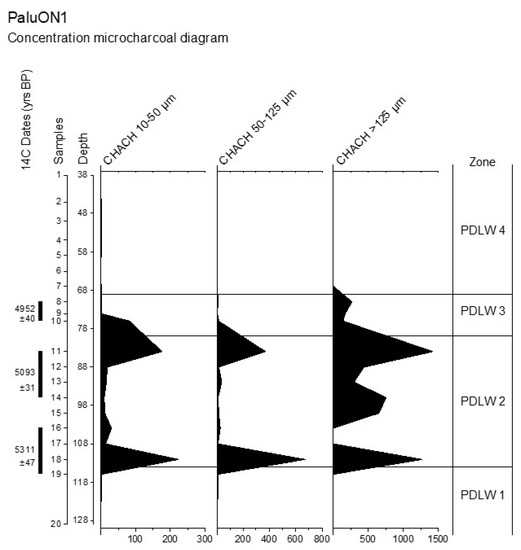
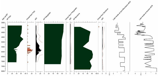
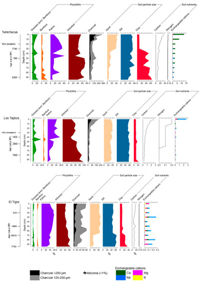
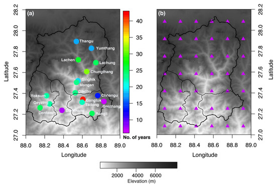
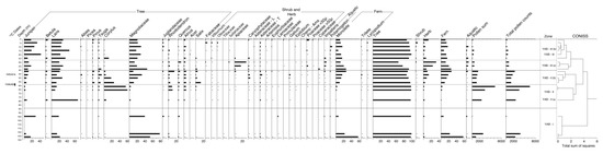
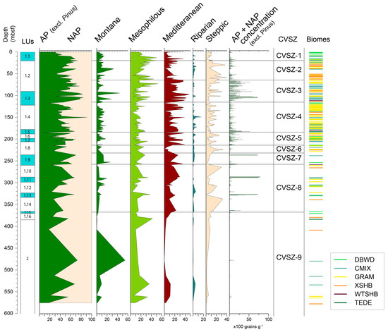
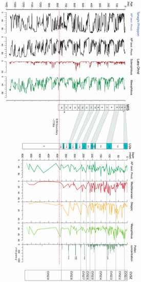
In central Italy, the Charterhouse of Calci hosts the Natural History Museum of the University of Pisa. This monumental monastery was founded in 1366 by Carthusian monks. The Charterhouse has experienced various transformations over the centuries, until its abandonment in the 1970s. Since 2018, interdisciplinary archaeological research focused on the monks’ gardens (and particularly: the Prior’s, the Apothecary’s, and the Master’s garden) and the green spaces outside the cloister walls, consisting of courtyards and orchards, to determine the individual (gardens) and collective (green spaces and surrounding woods) practices adopted by Carthusians. Palynology and archaeobotany have allowed to reconstruct the plant biodiversity, with flowers and ornamental, aromatic, and medicinal herbs that grew in the gardens, as well as the management of local hilly woods and agricultural practices, including the cultivation of fruit trees, such as chestnut, olive tree, almond tree, and grapevine. Our research has been based on a solid theoretical approach, interpreting archaeological and archaeobotanical data in relation to the intricate network of human and non-human connections. Gardens are seen as a co-creation made together by human and non-human agencies, and their diachronic transformation is read as an expression of personalities of the monks, feelings, and connections with nature and divinity.
Full article
(This article belongs to the Special Issue Palynology for Sustainability: A Classical and Versatile Tool for New Challenges)
►
Show Figures
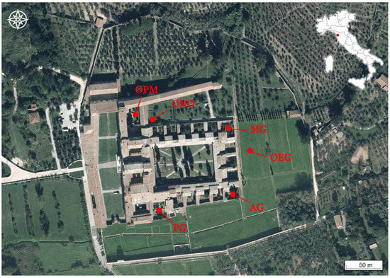
Figure 1


