


ISPRS Int. J. Geo-Inf. 2023, 12(8), 331; https://doi.org/10.3390/ijgi12080331 - 08 Aug 2023
Abstract
►
Show Figures
Personalized mappings become popular among the public with the support of data diversity and device diversity. To develop personalized maps, constructing map symbols through automated ways is beneficial. The formal representation of map symbols (i.e., expressing map symbols by mathematical operators) is fundamental
[...] Read more.
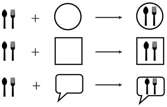
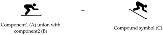
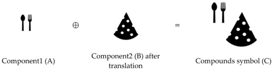
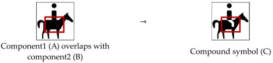
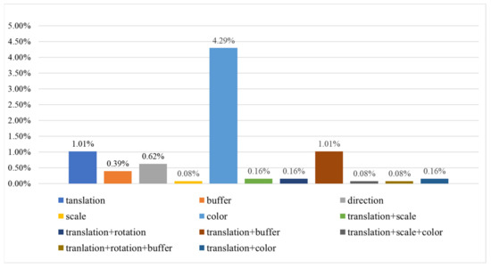
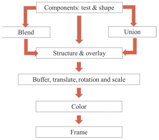
Personalized mappings become popular among the public with the support of data diversity and device diversity. To develop personalized maps, constructing map symbols through automated ways is beneficial. The formal representation of map symbols (i.e., expressing map symbols by mathematical operators) is fundamental to the automated construction of map symbols. A previous study to evaluate the feasibility of structures of Chinese characters for representing map symbols shows that 77.5% of map symbols can be represented by them, although there are imperfections in some cases. It means that: (1) the other 22.5% of symbols should be formally represented by other mathematical solutions, and (2) those imperfect cases should be made perfect through some modification or refinements. In this study, we solve the representation problems of these two types of map symbols (i.e., the map symbol did not or imperfectly fit the structures of Chinese characters) by employing additional basic operators and proposing some metric and color modifications. To validate these proposed solutions, experiments have been carried out by using eight sets of symbols that are publicly available (e.g., Google Icons). The results indicated that almost all the map symbols can be formally represented with additional operators and metric and color modifications. The percentages of map symbols that did not fit structures of Chinese characters solved by these operators and modifications are 2.4% and 20.1%, respectively. The percentages of map symbols that imperfectly fit them solved by these operators and modifications are 8.7% and 8%, respectively. This work could not only enrich cartographic theory but also prompt the mathematization of map symbol construction.
Full article
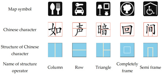
Figure 1


