


Drones 2023, 7(8), 520; https://doi.org/10.3390/drones7080520 - 08 Aug 2023
Abstract
This paper experimentally analyzed the cognitive load of users based on different methods of operating hovering objects, such as drones. The traditional gamepad-type control method (2D) was compared with a control method that mapped the movement directions of the drone to the natural
[...] Read more.
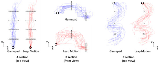
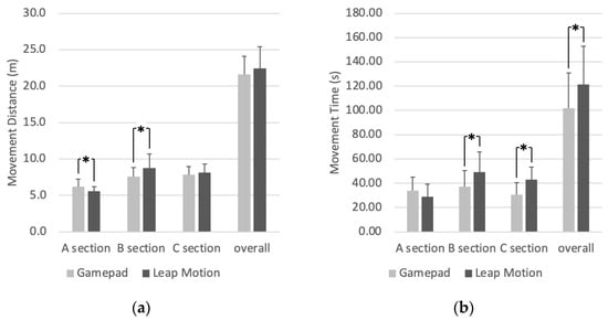
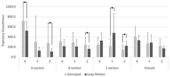
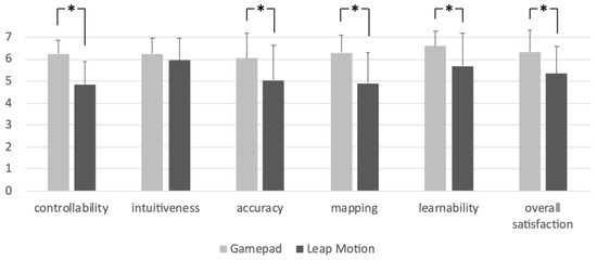
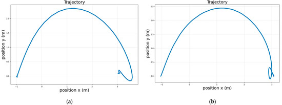
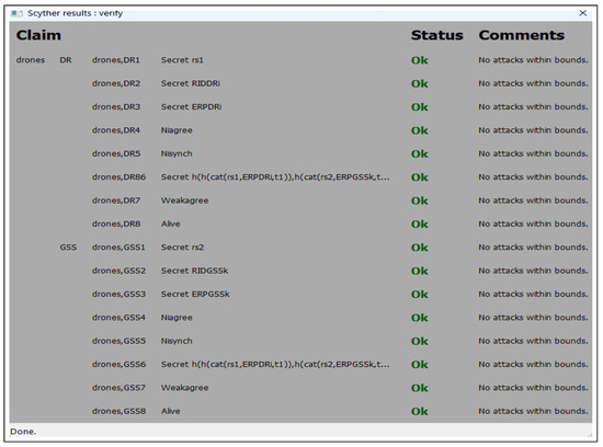
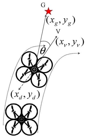
This paper experimentally analyzed the cognitive load of users based on different methods of operating hovering objects, such as drones. The traditional gamepad-type control method (2D) was compared with a control method that mapped the movement directions of the drone to the natural manipulation gestures of the user using a Leap Motion device (3D). Twenty participants operated the drone on an obstacle course using the two control methods. The drone’s trajectory was measured using motion-capture equipment with a reflective marker. The distance traveled by the drone, operation time, and trajectory smoothness were calculated and compared between the two control methods. The results showed that when the drone’s movements were mapped to the user’s natural directional gestures, the drone’s 3D movements were perceived as more natural and smoother. A more intuitive drone control method can reduce cognitive load and minimize operational errors, making it more user friendly and efficient. However, due to the users’ lack of familiarity with Leap Motion, it resulted in longer distance and time and lower subjective satisfaction; therefore, a more improved 3D control method over Leap Motion is needed to address the limitations.
Full article
(This article belongs to the Special Issue Navigation, Control and Mission Planning Advances for Safe, Efficient and Autonomous Drones)
►
Show Figures
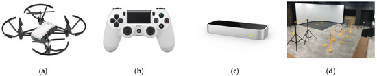
Figure 1


.jpg)


